IPaC resource list
This report is an automatically generated list of species and other resources such as critical habitat (collectively referred to as trust resources) under the U.S. Fish and Wildlife Service's (USFWS) jurisdiction that are known or expected to be on or near the project area referenced below. The list may also include trust resources that occur outside of the project area, but that could potentially be directly or indirectly affected by activities in the project area. However, determining the likelihood and extent of effects a project may have on trust resources typically requires gathering additional site-specific (e.g., vegetation/species surveys) and project-specific (e.g., magnitude and timing of proposed activities) information.
Below is a summary of the project information you provided and contact information for the USFWS office(s) with jurisdiction in the defined project area. Please read the introduction to each section that follows (Endangered Species, Migratory Birds, USFWS Facilities, and NWI Wetlands) for additional information applicable to the trust resources addressed in that section.
Location
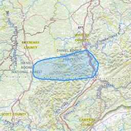
Local offices
Endangered species
This resource list is for informational purposes only and does not constitute an analysis of project level impacts.
The primary information used to generate this list is the known or expected range of each species. Additional areas of influence (AOI) for species are also considered. An AOI includes areas outside of the species range if the species could be indirectly affected by activities in that area (e.g., placing a dam upstream of a fish population even if that fish does not occur at the dam site, may indirectly impact the species by reducing or eliminating water flow downstream). Because species can move, and site conditions can change, the species on this list are not guaranteed to be found on or near the project area. To fully determine any potential effects to species, additional site-specific and project-specific information is often required.
Section 7 of the Endangered Species Act requires Federal agencies to "request of the Secretary information whether any species which is listed or proposed to be listed may be present in the area of such proposed action" for any project that is conducted, permitted, funded, or licensed by any Federal agency. A letter from the local office and a species list which fulfills this requirement can only be obtained by requesting an official species list from either the Regulatory Review section in IPaC (see directions below) or from the local field office directly.
For project evaluations that require USFWS concurrence/review, please return to the IPaC website and request an official species list by doing the following:
- Draw the project location and click CONTINUE.
- Click DEFINE PROJECT.
- Log in (if directed to do so).
- Provide a name and description for your project.
- Click REQUEST SPECIES LIST.
Listed species1 and their critical habitats are managed by the Ecological Services Program of the U.S. Fish and Wildlife Service (USFWS) and the fisheries division of the National Oceanic and Atmospheric Administration (NOAA Fisheries2).
Species and critical habitats under the sole responsibility of NOAA Fisheries are not shown on this list. Please contact NOAA Fisheries for species under their jurisdiction.
Additional information on endangered species data is provided below.
-
Species listed under the Endangered Species Act are threatened or endangered; IPaC also shows species that are candidates, or proposed, for listing. See the listing status page for more information. IPaC only shows species that are regulated by USFWS (see FAQ).
- NOAA Fisheries, also known as the National Marine Fisheries Service (NMFS), is an office of the National Oceanic and Atmospheric Administration within the Department of Commerce.
The following species are potentially affected by activities in this location:

Status |
Endangered; A species in danger of extinction throughout all or a significant portion of its range. |
Description |
Long, glossy fur, light brown to brown. Ears dark, usually black; longer than in any other myotis; when laid forward extend 1/4 cm (7 mm) beyond nose. Tragus long and thin. Calcar keeled. |
Critical habitat |
No critical habitat has been designated for this species.
|
Species Guidelines |
|

Status |
Endangered; A species in danger of extinction throughout all or a significant portion of its range. |
Description |
The Indiana bat is a medium-sized Myotis, closely resembling the little brown bat (Myotis lucifugus) but differing in coloration. Its fur is a dull grayish chestnut rather than bronze, with the basal portion of the hairs on the back a dull-lead color. This bat's underparts are pinkish to cinnamon, and its hind feet are smaller and more delicate than in M. lucifugus. The calcar (heel of the foot) is strongly keeled. |
Critical habitat |
There is final critical habitat for this species.
(published in the Federal Register on
September 22, 1977
).
Your location does not overlap the critical habitat.
|
Species Guidelines |
|

Status |
Endangered; A species in danger of extinction throughout all or a significant portion of its range. |
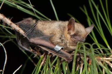
Description |
The northern long-eared bat is a medium-sized bat about 3 to 3.7 inches in length but with a wingspan of 9 to 10 inches. As its name suggests, this bat is distinguished by its long ears, particularly as compared to other bats in its genus, Myotis, which are actually bats noted for their small ears (Myotis means mouse-eared). The northern long-eared bat is found across much of the eastern and north central United States and all Canadian provinces from the Atlantic coast west to the southern Northwest Territories and eastern British Columbia. The species range includes 37 states. White-nose syndrome, a fungal disease known to affect bats, is currently the predominant threat to this bat, especially throughout the Northeast where the species has declined by up to 99 percent from pre-white-nose syndrome levels at many hibernation sites. Although the disease has not yet spread throughout the northern long-eared bats entire range (white-nose syndrome is currently found in at least 25 of 37 states where the northern long-eared bat occurs), it continues to spread. Experts expect that where it spreads, it will have the same impact as seen in the Northeast. |
Critical habitat |
No critical habitat has been designated for this species.
|
Species Guidelines |
|
Status |
Proposed Endangered; Species proposed for official listing as endangered. |
Description |
The tricolored bat is a small insectivorous bat that is distinguished by its unique tricolored fur and often appears yellowish to nearly orange. The once common species is wide ranging across the eastern and central United States and portions of southern Canada, Mexico and Central America. During the winter, tricolored bats are often found in caves and abandoned mines, although in the southern United States, where caves are sparse, tricolored bats are often found roosting in road-associated culverts where they exhibit shorter torpor bouts and forage during warm nights. During the spring, summer, and fall, tricolored bats are found in forested habitats where they roost in trees, primarily among leaves of live or recently dead deciduous hardwood trees, but may also be found in Spanish moss, pine trees, and occasionally human structures. Tricolored bats face extinction due primarily to the rangewide impacts of white-nose syndrome, a deadly disease affecting cave-dwelling bats across the continent. White-nose syndrome has caused estimated declines of more than 90 percent in affected tricolored bat colonies across the majority of the species range. To address the growing threat of white-nose syndrome to the tricolored bat and other bats across North America, the U.S. Fish and Wildlife Service is leading the White-nose Syndrome National Response Team, a coordinated effort of more than 150 non-governmental organizations, institutions, Tribes, and state and federal agencies. Together we are conducting critical white-nose syndrome research and developing management strategies to minimize impacts of the disease and recover affected bat populations. For more information on white-nose syndrome, please see: https://www.whitenosesyndrome.org/ For more information on tricolored bats, please see: https://www.fws.gov/species/tricolored-bat-perimyotis-subflavus |
Critical habitat |
No critical habitat has been designated for this species.
|

Status |
Endangered; A species in danger of extinction throughout all or a significant portion of its range. |
Description |
Plecotus townsendii is a medium-sized bat with forearms measuring 39 to 48 millimeters (mm) long and weighing 7 to 12 grams. Total body length is 98 mm, the tail is 46 mm, and the hind foot is 11 mm long. This bat's long ears (over 2.5 centimeters) and facial glands on either side of the snout are quite distinctive. Fur is light to dark brown depending upon the age of the individual and the subspecies. The only other eastern bat that resembles the Ozark or the Virginia big-eared bat is P. rafinesquii (Rafinesque's big-eared bat). Rafinesque's big-eared bat has toe hairs that extend beyond the end of the toes and the dorsal fur is gray rather than brown. The belly fur of Rafinesque's big-eared bat is white or whitish rather than light brown or buff (Schmidly 1991, Barbour and Davis 1969). The Ozark and Virginia big-eared bats do not have overlapping ranges. Copulation occurs in the fall and winter and the females store the sperm until ovulation in late winter or spring. Gestation takes about 3 months and a single pup is born in May or June. Development is fairly rapid and the young are on their own within 2 months (Barbour and Davis 1969, Schmidly 1991, Kunz and Martin 1982). |
Critical habitat |
There is final critical habitat for this species.
(published in the Federal Register on
November 30, 1979
).
Your location does not overlap the critical habitat.
|
Species Guidelines |
|

Status |
Endangered; A species in danger of extinction throughout all or a significant portion of its range. |
Description |
No description available |
Critical habitat |
There is final critical habitat for this species.
(published in the Federal Register on
October 16, 2012
).
Your location overlaps the critical habitat.
|
Species Guidelines |
|

Population |
Wherever found; Except where listed as Experimental Populations |
Status |
Endangered; A species in danger of extinction throughout all or a significant portion of its range. |
Description |
No description available |
Critical habitat |
No critical habitat has been designated for this species.
|
Species Guidelines |
|

Status |
Endangered; A species in danger of extinction throughout all or a significant portion of its range. |
Description |
No description available |
Critical habitat |
There is final critical habitat for this species.
(published in the Federal Register on
August 31, 2004
).
Your location overlaps the critical habitat.
|

Population |
Wherever found; Except where listed as Experimental Populations |
Status |
Endangered; A species in danger of extinction throughout all or a significant portion of its range. |
Description |
No description available |
Critical habitat |
There is final critical habitat for this species.
(published in the Federal Register on
August 31, 2004
).
Your location does not overlap the critical habitat.
|
Species Guidelines |
|

Status |
Endangered; A species in danger of extinction throughout all or a significant portion of its range. |
Description |
The following description of the Fluted Kidneyshell is taken from Parmalee and Bogan (1998, pp. 204205) and Williams et al. (2008, p. 627). The Fluted Kidneyshell is a relatively large mussel that reaches about 13 centimeters (cm) (5 inches (in)) in length. The shape of the shell is roughly oval elongate, and the solid, relatively heavy valves (shells) are moderately inflated (Figure 2.2). A series of flutings (parallel ridges or grooves) characterizes the posterior slope of each valve. Shell texture is smooth and somewhat shiny in young specimens, becoming duller with age. Shell color is greenish yellow, becoming brownish with age, with several broken, wide green rays. Internally, there are two types of teeth, projections that keep the shell from being opened by external forces and are interlocking structures used to stabilize opposing shell halves. The pseudocardinal teeth (near the anterior end of the valve hinge line) are stumpy and triangular in shape. The lateral teeth (hinge teeth) are relatively heavy and nearly straight, with two in the left valve and one in the right valve. The color of the nacre (mother-of-pearl) is bluish-white to dull white with a wash of salmon in the older part of the shell (beak cavity). Most anatomical features are tan or brown and vary from rusty orange to shades of reddish or grayish brown. Only a few select features will be detailed, but further information of soft anatomy is described by Williams et al. (2008, p. 627). The mantle is tan; the outside apertures vary from tan or brown, often rusty, and mottled with dark brown or grayish brown; the visceral mass (collective assemblage of internal organs) is pearly white to creamy white; the foot is creamy white to tan; and the gills are tan. The gills are only connected to the visceral mass anteriorly; the outer gills are marsupial, holding glochidia (larvae) in short folds when gravid. |
Critical habitat |
There is final critical habitat for this species.
(published in the Federal Register on
September 26, 2013
).
Your location does not overlap the critical habitat.
|
Species Guidelines |
|

Status |
Endangered; A species in danger of extinction throughout all or a significant portion of its range. |
Description |
The Tan riffleshell is a medium-sized mussel characterized by dull brownish-green shell with numerous evenly distributed faint green rays over the valve surface. The Tennessee and Cumberland River basins historically contained the greatest diversity of freshwater mussels anywhere in the world. Species specific to this area are referred to as "Cumberlandian". |
Critical habitat |
No critical habitat has been designated for this species.
|
Species Guidelines |
|

Status |
Proposed Threatened; Species proposed for official listing as threatened. |
Description |
For information on monarch conservation, visit https://www.fws.gov/initiative/pollinators/monarchs, http://www.mafwa.org/?page_id=2347, and, for the West, https://wafwa.org/committees-working-groups/monarch-working-group/. Adult monarch butterflies are large and conspicuous, with bright orange wings surrounded by a black border and covered with black veins. The black border has a double row of white spots, present on the upper side of the wings. Adult monarchs are sexually dimorphic, with males having narrower wing venation and scent patches. The bright coloring of a monarch serves as a warning to predators that eating them can be toxic. During the breeding season, monarchs lay their eggs on their obligate milkweed host plant (primarily Asclepias spp.), and larvae emerge after two to five days. Larvae develop through five larval instars (intervals between molts) over a period of 9 to 18 days, feeding on milkweed and sequestering toxic chemicals (cardenolides) as a defense against predators. The larva then pupates into a chrysalis before emerging 6 to 14 days later as an adult butterfly. There are multiple generations of monarchs produced during the breeding season, with most adult butterflies living approximately two to five weeks; overwintering adults enter into reproductive diapause (suspended reproduction) and live six to nine months. In many regions where monarchs are present, monarchs breed year-round. Individual monarchs in temperate climates, such as eastern and western North America, undergo long-distance migration, and live for an extended period of time. In the fall, in both eastern and western North America, monarchs begin migrating to their respective overwintering sites. This migration can take monarchs distances of over 3,000 km and last for over two months. In early spring (February-March), surviving monarchs break diapause and mate at the overwintering sites before dispersing. The same individuals that undertook the initial southward migration begin flying back through the breeding grounds and their offspring start the cycle of generational migration over again. |
Critical habitat |
There is proposed critical habitat for this species.
(published in the Federal Register on
December 12, 2024
).
Your location does not overlap the critical habitat.
|

Population |
|
Status |
Threatened; A species likely to become endangered within the foreseeable future throughout all or a significant portion of its range. |
Description |
No description available |
Critical habitat |
No critical habitat has been designated for this species.
|
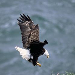
Bald & Golden Eagles
Bald and Golden Eagles are protected under the Bald and Golden Eagle Protection Act 2 and the Migratory Bird Treaty Act (MBTA) 1. Any person or organization who plans or conducts activities that may result in impacts to Bald or Golden Eagles, or their habitats, should follow appropriate regulations and consider implementing appropriate avoidance and minimization measures, as described in the various links on this page.
Additional information can be found using the following links:
- Eagle Management https://www.fws.gov/program/eagle-management
- Measures for avoiding and minimizing impacts to birds https://www.fws.gov/library/collections/avoiding-and-minimizing-incidental-take-migratory-birds
- Nationwide avoidance and minimization measures for birds https://www.fws.gov/sites/default/files/documents/nationwide-standard-conservation-measures.pdf
- Supplemental Information for Migratory Birds and Eagles in IPaC https://www.fws.gov/media/supplemental-information-migratory-birds-and-bald-and-golden-eagles-may-occur-project-action
There are Bald Eagles and/or Golden Eagles in your project area.
Measures for Proactively Minimizing Eagle ImpactsFor information on how to best avoid and minimize disturbance to nesting bald eagles, please review the National Bald Eagle Management Guidelines. You may employ the timing and activity-specific distance recommendations in this document when designing your project/activity to avoid and minimize eagle impacts. For bald eagle information specific to Alaska, please refer to Bald Eagle Nesting and Sensitivity to Human Activity.
The FWS does not currently have guidelines for avoiding and minimizing disturbance to nesting Golden Eagles. For site-specific recommendations regarding nesting Golden Eagles, please consult with the appropriate Regional Migratory Bird Office or Ecological Services Field Office.
If disturbance or take of eagles cannot be avoided, an incidental take permit may be available to authorize any take that results from, but is not the purpose of, an otherwise lawful activity. For assistance making this determination for Bald Eagles, visit the Do I Need A Permit Tool. For assistance making this determination for golden eagles, please consult with the appropriate Regional Migratory Bird Office or Ecological Services Field Office.
Ensure Your Eagle List is Accurate and CompleteIf your project area is in a poorly surveyed area in IPaC, your list may not be complete and you may need to rely on other resources to determine what species may be present (e.g. your local FWS field office, state surveys, your own surveys). Please review the Supplemental Information on Migratory Birds and Eagles, to help you properly interpret the report for your specified location, including determining if there is sufficient data to ensure your list is accurate.
For guidance on when to schedule activities or implement avoidance and minimization measures to reduce impacts to bald or golden eagles on your list, see the "Probability of Presence Summary" below to see when these bald or golden eagles are most likely to be present and breeding in your project area.
Review the FAQsThe FAQs below provide important additional information and resources.
Level of Concern |
This is not a Bird of Conservation Concern (BCC) in this area, but warrants attention because of the Eagle Act or for potential susceptibilities in offshore areas from certain types of development or activities. |
||||||||||||||||||||||||
Presence |
no data
survey effort
breeding season
probability of presence
What's this?
|
||||||||||||||||||||||||
Description |
A large raptor, the bald eagle has a wingspread of about 7 feet. Adults have a dark brown body and wings, white head and tail, and a yellow beak. Juveniles are mostly brown with white mottling on the body, tail, and undersides of wings. Adult plumage usually is obtained by the 6th year. In flight, the Bald Eagle often soars or glides with the wings held at a right angle to the body. As in most other raptors, females are larger than males; sexes otherwise similar in appearance. References for Species Profile
|
||||||||||||||||||||||||
Probability of Presence Summary
The graphs below provide our best understanding of when birds of concern are most likely to be present in your project area. This information can be used to tailor and schedule your project activities to avoid or minimize impacts to birds. Please make sure you read "Supplemental Information on Migratory Birds and Eagles", specifically the FAQ section titled "Proper Interpretation and Use of Your Migratory Bird Report" before using or attempting to interpret this report.
Probability of Presence ()
Each green bar represents the bird's relative probability of presence in the 10km grid cell(s) your project overlaps during a particular week of the year. (A year is represented as 12 4-week months.) A taller bar indicates a higher probability of species presence. The survey effort (see below) can be used to establish a level of confidence in the presence score. One can have higher confidence in the presence score if the corresponding survey effort is also high.
How is the probability of presence score calculated? The calculation is done in three steps:
- The probability of presence for each week is calculated as the number of survey events in the week where the species was detected divided by the total number of survey events for that week. For example, if in week 12 there were 20 survey events and the Spotted Towhee was found in 5 of them, the probability of presence of the Spotted Towhee in week 12 is 0.25.
- To properly present the pattern of presence across the year, the relative probability of presence is calculated. This is the probability of presence divided by the maximum probability of presence across all weeks. For example, imagine the probability of presence in week 20 for the Spotted Towhee is 0.05, and that the probability of presence at week 12 (0.25) is the maximum of any week of the year. The relative probability of presence on week 12 is 0.25/0.25 = 1; at week 20 it is 0.05/0.25 = 0.2.
- The relative probability of presence calculated in the previous step undergoes a statistical conversion so that all possible values fall between 0 and 10, inclusive. This is the probability of presence score.
To see a bar's probability of presence score, simply hover your mouse cursor over the bar.
Breeding Season ()Yellow bars denote a very liberal estimate of the time-frame inside which the bird breeds across its entire range. If there are no yellow bars shown for a bird, it does not breed in your project area.
Survey Effort ()Vertical black lines superimposed on probability of presence bars indicate the number of surveys performed for that species in the 10km grid cell(s) your project area overlaps. The number of surveys is expressed as a range, for example, 33 to 64 surveys.
To see a bar's survey effort range, simply hover your mouse cursor over the bar.
No Data ()A week is marked as having no data if there were no survey events for that week.
Survey TimeframeSurveys from only the last 10 years are used in order to ensure delivery of currently relevant information. The exception to this is areas off the Atlantic coast, where bird returns are based on all years of available data, since data in these areas is currently much more sparse.
| Species | Jan | Feb | Mar | Apr | May | Jun | Jul | Aug | Sep | Oct | Nov | Dec |
|---|---|---|---|---|---|---|---|---|---|---|---|---|
|
Bald Eagle
Non-BCC Vulnerable
Non-BCC Vulnerable
|
Bald & Golden Eagles FAQs
The potential for eagle presence is derived from data provided by the Avian Knowledge Network (AKN). The AKN data is based on a growing collection of survey, banding, and citizen science datasets and is queried and filtered to return a list of those birds reported as occurring in the 10km grid cell(s) which your project intersects, and that have been identified as warranting special attention because they are an eagle (Bald and Golden Eagle Protection Act requirements may apply).
Proper interpretation and use of your eagle reportOn the graphs provided, please look carefully at the survey effort (indicated by the black vertical line) and for the existence of the "no data" indicator (a red horizontal line). A high survey effort is the key component. If the survey effort is high, then the probability of presence score can be viewed as more dependable. In contrast, a low survey effort line or no data line (red horizontal) means a lack of data and, therefore, a lack of certainty about presence of the species. This list is not perfect; it is simply a starting point for identifying what birds have the potential to be in your project area, when they might be there, and if they might be breeding (which means nests might be present). The list and associated information help you know what to look for to confirm presence and helps guide you in knowing when to implement avoidance and minimization measures to eliminate or reduce potential impacts from your project activities or get the appropriate permits should presence be confirmed.
To see what part of a particular bird's range your project area falls within (i.e. breeding, wintering, migrating, or resident), you may query your location using the RAIL Tool and view the range maps provided for birds in your area at the bottom of the profiles provided for each bird in your results. If an eagle on your IPaC migratory bird species list has a breeding season associated with it (indicated by yellow vertical bars on the phenology graph in your “IPaC PROBABILITY OF PRESENCE SUMMARY” at the top of your results list), there may be nests present at some point within the timeframe specified. If "Breeds elsewhere" is indicated, then the bird likely does not breed in your project area.
Interpreting the Probability of Presence Graphs
Each green bar represents the bird's relative probability of presence in the 10km grid cell(s) your project overlaps during a particular week of the year. A taller bar indicates a higher probability of species presence. The survey effort can be used to establish a level of confidence in the presence score.
How is the probability of presence score calculated? The calculation is done in three steps:The probability of presence for each week is calculated as the number of survey events in the week where the species was detected divided by the total number of survey events for that week. For example, if in week 12 there were 20 survey events and the Spotted Towhee was found in 5 of them, the probability of presence of the Spotted Towhee in week 12 is 0.25.
To properly present the pattern of presence across the year, the relative probability of presence is calculated. This is the probability of presence divided by the maximum probability of presence across all weeks. For example, imagine the probability of presence in week 20 for the Spotted Towhee is 0.05, and that the probability of presence at week 12 (0.25) is the maximum of any week of the year. The relative probability of presence on week 12 is 0.25/0.25 = 1; at week 20 it is 0.05/0.25 = 0.2.
The relative probability of presence calculated in the previous step undergoes a statistical conversion so that all possible values fall between 0 and 10, inclusive. This is the probability of presence score.
Breeding Season ()Yellow bars denote a very liberal estimate of the time-frame inside which the bird breeds across its entire range. If there are no yellow bars shown for a bird, it does not breed in your project area.
Survey Effort ()Vertical black lines superimposed on probability of presence bars indicate the number of surveys performed for that species in the 10km grid cell(s) your project area overlaps.
No Data ()A week is marked as having no data if there were no survey events for that week.
Survey TimeframeSurveys from only the last 10 years are used in order to ensure delivery of currently relevant information. The exception to this is areas off the Atlantic coast, where bird returns are based on all years of available data, since data in these areas is currently much more sparse.
Migratory birds
The Migratory Bird Treaty Act (MBTA) 1 prohibits the take (including killing, capturing, selling, trading, and transport) of protected migratory bird species without prior authorization by the Department of Interior U.S. Fish and Wildlife Service (Service).
-
The Migratory Birds Treaty Act of 1918.
-
The Bald and Golden Eagle Protection Act of 1940.
Additional information can be found using the following links:
- Eagle Management https://www.fws.gov/program/eagle-management
- Measures for avoiding and minimizing impacts to birds https://www.fws.gov/library/collections/avoiding-and-minimizing-incidental-take-migratory-birds
- Nationwide avoidance and minimization measures for birds
- Supplemental Information for Migratory Birds and Eagles in IPaC https://www.fws.gov/media/supplemental-information-migratory-birds-and-bald-and-golden-eagles-may-occur-project-action
Measures for Proactively Minimizing Migratory Bird Impacts
Your IPaC Migratory Bird list showcases birds of concern, including Birds of Conservation Concern (BCC), in your project location. This is not a comprehensive list of all birds found in your project area. However, you can help proactively minimize significant impacts to all birds at your project location by implementing the measures in the Nationwide avoidance and minimization measures for birds document, and any other project-specific avoidance and minimization measures suggested at the link Measures for avoiding and minimizing impacts to birds for the birds of concern on your list below.
Ensure Your Migratory Bird List is Accurate and Complete
If your project area is in a poorly surveyed area, your list may not be complete and you may need to rely on other resources to determine what species may be present (e.g. your local FWS field office, state surveys, your own surveys). Please review the Supplemental Information on Migratory Birds and Eagles document, to help you properly interpret the report for your specified location, including determining if there is sufficient data to ensure your list is accurate.
For guidance on when to schedule activities or implement avoidance and minimization measures to reduce impacts to migratory birds on your list, see the "Probability of Presence Summary" below to see when these birds are most likely to be present and breeding in your project area.
Review the FAQsThe FAQs below provide important additional information and resources.
Level of Concern |
This is not a Bird of Conservation Concern (BCC) in this area, but warrants attention because of the Eagle Act or for potential susceptibilities in offshore areas from certain types of development or activities. |
||||||||||||||||||||||||
Presence |
no data
survey effort
breeding season
probability of presence
What's this?
|
||||||||||||||||||||||||
Description |
A large raptor, the bald eagle has a wingspread of about 7 feet. Adults have a dark brown body and wings, white head and tail, and a yellow beak. Juveniles are mostly brown with white mottling on the body, tail, and undersides of wings. Adult plumage usually is obtained by the 6th year. In flight, the Bald Eagle often soars or glides with the wings held at a right angle to the body. As in most other raptors, females are larger than males; sexes otherwise similar in appearance. References for Species Profile
|
||||||||||||||||||||||||
Level of Concern |
This is a Bird of Conservation Concern (BCC) throughout its range in the continental USA and Alaska. |
||||||||||||||||||||||||
Presence |
no data
survey effort
breeding season
probability of presence
What's this?
|
||||||||||||||||||||||||
Description |
No description available |
||||||||||||||||||||||||
Level of Concern |
This is a Bird of Conservation Concern (BCC) only in particular Bird Conservation Regions (BCRs) in the continental USA |
||||||||||||||||||||||||
Presence |
no data
survey effort
breeding season
probability of presence
What's this?
|
||||||||||||||||||||||||
Description |
No description available |
||||||||||||||||||||||||
Level of Concern |
This is a Bird of Conservation Concern (BCC) throughout its range in the continental USA and Alaska. |
||||||||||||||||||||||||
Presence |
no data
survey effort
breeding season
probability of presence
What's this?
|
||||||||||||||||||||||||
Description |
No description available |
||||||||||||||||||||||||
Probability of Presence Summary
The graphs below provide our best understanding of when birds of concern are most likely to be present in your project area. This information can be used to tailor and schedule your project activities to avoid or minimize impacts to birds. Please make sure you read "Supplemental Information on Migratory Birds and Eagles", specifically the FAQ section titled "Proper Interpretation and Use of Your Migratory Bird Report" before using or attempting to interpret this report.
Probability of Presence ()
Each green bar represents the bird's relative probability of presence in the 10km grid cell(s) your project overlaps during a particular week of the year. (A year is represented as 12 4-week months.) A taller bar indicates a higher probability of species presence. The survey effort (see below) can be used to establish a level of confidence in the presence score. One can have higher confidence in the presence score if the corresponding survey effort is also high.
How is the probability of presence score calculated? The calculation is done in three steps:
- The probability of presence for each week is calculated as the number of survey events in the week where the species was detected divided by the total number of survey events for that week. For example, if in week 12 there were 20 survey events and the Spotted Towhee was found in 5 of them, the probability of presence of the Spotted Towhee in week 12 is 0.25.
- To properly present the pattern of presence across the year, the relative probability of presence is calculated. This is the probability of presence divided by the maximum probability of presence across all weeks. For example, imagine the probability of presence in week 20 for the Spotted Towhee is 0.05, and that the probability of presence at week 12 (0.25) is the maximum of any week of the year. The relative probability of presence on week 12 is 0.25/0.25 = 1; at week 20 it is 0.05/0.25 = 0.2.
- The relative probability of presence calculated in the previous step undergoes a statistical conversion so that all possible values fall between 0 and 10, inclusive. This is the probability of presence score.
To see a bar's probability of presence score, simply hover your mouse cursor over the bar.
Breeding Season ()Yellow bars denote a very liberal estimate of the time-frame inside which the bird breeds across its entire range. If there are no yellow bars shown for a bird, it does not breed in your project area.
Survey Effort ()Vertical black lines superimposed on probability of presence bars indicate the number of surveys performed for that species in the 10km grid cell(s) your project area overlaps. The number of surveys is expressed as a range, for example, 33 to 64 surveys.
To see a bar's survey effort range, simply hover your mouse cursor over the bar.
No Data ()A week is marked as having no data if there were no survey events for that week.
Survey TimeframeSurveys from only the last 10 years are used in order to ensure delivery of currently relevant information. The exception to this is areas off the Atlantic coast, where bird returns are based on all years of available data, since data in these areas is currently much more sparse.
| Species | Jan | Feb | Mar | Apr | May | Jun | Jul | Aug | Sep | Oct | Nov | Dec |
|---|---|---|---|---|---|---|---|---|---|---|---|---|
|
Bald Eagle
Non-BCC Vulnerable
Non-BCC Vulnerable
|
||||||||||||
|
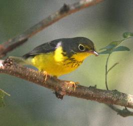
Canada Warbler
BCC Rangewide (CON)
BCC Rangewide (CON)
|
||||||||||||
|
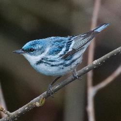
Cerulean Warbler
BCC Rangewide (CON)
BCC Rangewide (CON)
|
||||||||||||
|
Chimney Swift
BCC Rangewide (CON)
BCC Rangewide (CON)
|
||||||||||||
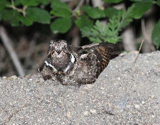
|
Eastern Whip-poor-will
BCC Rangewide (CON)
BCC Rangewide (CON)
|
||||||||||||
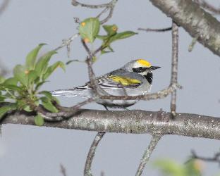
|
Golden-winged warbler
BCC Rangewide (CON)
BCC Rangewide (CON)
|
||||||||||||
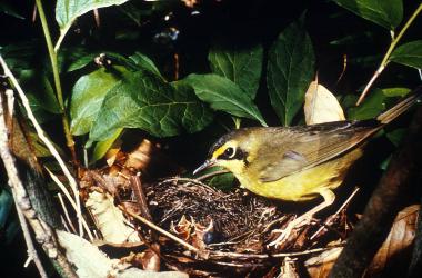
|
Kentucky Warbler
BCC Rangewide (CON)
BCC Rangewide (CON)
|
||||||||||||
|
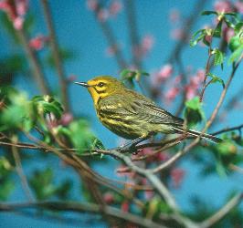
Prairie Warbler
BCC Rangewide (CON)
BCC Rangewide (CON)
|
||||||||||||
|
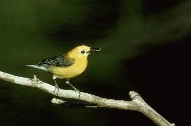
Prothonotary Warbler
BCC Rangewide (CON)
BCC Rangewide (CON)
|
||||||||||||
|
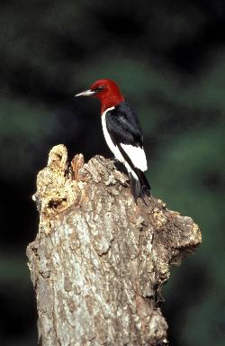
Red-headed Woodpecker
BCC Rangewide (CON)
BCC Rangewide (CON)
|
||||||||||||
|
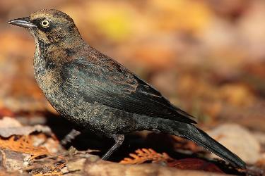
Rusty Blackbird
BCC - BCR
BCC - BCR
|
||||||||||||
|
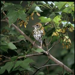
Wood Thrush
BCC Rangewide (CON)
BCC Rangewide (CON)
|
Migratory Bird FAQs
Nationwide Avoidance & Minimization Measures for Birds describes measures that can help avoid and minimize impacts to all birds at any location year-round. When birds may be breeding in the area, identifying the locations of any active nests and avoiding their destruction is one of the most effective ways to minimize impacts. To see when birds are most likely to occur and breed in your project area, view the Probability of Presence Summary. Additional measures or permits may be advisable depending on the type of activity you are conducting and the type of infrastructure or bird species present on your project site.
The Migratory Bird Resource List is comprised of Birds of Conservation Concern (BCC) and other species that may warrant special attention in your project location, such as those listed under the Endangered Species Act or the Bald and Golden Eagle Protection Act and those species marked as “Vulnerable”. See the FAQ “What are the levels of concern for migratory birds?” for more information on the levels of concern covered in the IPaC migratory bird species list.
The migratory bird list generated for your project is derived from data provided by the Avian Knowledge Network (AKN). The AKN data is based on a growing collection of survey, banding, and citizen science datasets and is queried and filtered to return a list of those birds reported as occurring in the 10km grid cell(s) with which your project intersects. These species have been identified as warranting special attention because they are BCC species in that area, an eagle (Bald and Golden Eagle Protection Act requirements may apply), or a species that has a particular vulnerability to offshore activities or development.
Again, the Migratory Bird Resource list includes only a subset of birds that may occur in your project area. It is not representative of all birds that may occur in your project area. To get a list of all birds potentially present in your project area, and to verify survey effort when no results present, please visit the Rapid Avian Information Locator (RAIL) Tool.
Subspecies profiles are included on the list of species present in your project area because observations in the AKN for the species are being detected. If the species are present, that means that the subspecies may also be present. If a subspecies shows up on your list, you may need to rely on other resources to determine if that subspecies may be present (e.g. your local FWS field office, state surveys, your own surveys).
The probability of presence graphs associated with your migratory bird list are based on data provided by the Avian Knowledge Network (AKN). This data is derived from a growing collection of survey, banding, and citizen science datasets.
Probability of presence data is continuously being updated as new and better information becomes available. To learn more about how the probability of presence graphs are produced and how to interpret them, go to the Probability of Presence Summary and then click on the "Tell me about these graphs" link.
To see what part of a particular bird's range your project area falls within (i.e. breeding, wintering, migrating, or resident), you may query your location using the RAIL Tool and view the range maps provided for birds in your area at the bottom of the profiles provided for each bird in your results. If a bird on your IPaC migratory bird species list has a breeding season associated with it (indicated by yellow vertical bars on the phenology graph in your “IPaC PROBABILITY OF PRESENCE SUMMARY” at the top of your results list), there may be nests present at some point within the timeframe specified. If "Breeds elsewhere" is indicated, then the bird likely does not breed in your project area.
Migratory birds delivered through IPaC fall into the following distinct categories of concern:
- "BCC Rangewide" birds are Birds of Conservation Concern (BCC) that are of concern throughout their range anywhere within the USA (including Hawaii, the Pacific Islands, Puerto Rico, and the Virgin Islands);
- "BCC - BCR" birds are BCCs that are of concern only in particular Bird Conservation Regions (BCRs) in the continental USA; and
- "Non-BCC - Vulnerable" birds are not BCC species in your project area, but appear on your list either because of the Bald and Golden Eagle Protection Act requirements (for eagles) or (for non-eagles) potential susceptibilities in offshore areas from certain types of development or activities (e.g. offshore energy development or longline fishing).
Although it is important to avoid and minimize impacts to all birds, efforts should be made, in particular, to avoid and minimize impacts to the birds on this list, especially BCC species. For more information on avoidance and minimization measures you can implement to help avoid and minimize migratory bird impacts, please see the FAQ “Tell me more about avoidance and minimization measures I can implement to avoid or minimize impacts to migratory birds”.
For additional details about the relative occurrence and abundance of both individual bird species and groups of bird species within your project area off the Atlantic Coast, please visit the Northeast Ocean Data Portal. The Portal also offers data and information about other taxa besides birds that may be helpful to you in your project review. Alternately, you may download the bird model results files underlying the portal maps through the NOAA NCCOS Integrative Statistical Modeling and Predictive Mapping of Marine Bird Distributions and Abundance on the Atlantic Outer Continental Shelf project webpage.
The migratory bird list generated is not a list of all birds in your project area, only a subset of birds of priority concern. To learn more about how your list is generated and see options for identifying what other birds may be in your project area, please see the FAQ "What does IPaC use to generate the migratory birds potentially occurring in my specified location". Please be aware this report provides the "probability of presence" of birds within the 10 km grid cell(s) that overlap your project; not your exact project footprint. On the graphs provided, please look carefully at the survey effort (indicated by the black vertical line) and for the existence of the "no data" indicator (a red horizontal line). A high survey effort is the key component. If the survey effort is high, then the probability of presence score can be viewed as more dependable. In contrast, a low survey effort bar or no data bar means a lack of data and, therefore, a lack of certainty about presence of the species. This list does not represent all birds present in your project area. It is simply a starting point for identifying what birds of concern have the potential to be in your project area, when they might be there, and if they might be breeding (which means nests might be present). The list and associated information help you know what to look for to confirm presence and helps guide implementation of avoidance and minimization measures to eliminate or reduce potential impacts from your project activities, should presence be confirmed. To learn more about avoidance and minimization measures, visit the FAQ "Tell me about avoidance and minimization measures I can implement to avoid or minimize impacts to migratory birds".
Interpreting the Probability of Presence GraphsEach green bar represents the bird's relative probability of presence in the 10km grid cell(s) your project overlaps during a particular week of the year. A taller bar indicates a higher probability of species presence. The survey effort can be used to establish a level of confidence in the presence score.
How is the probability of presence score calculated? The calculation is done in three steps:The probability of presence for each week is calculated as the number of survey events in the week where the species was detected divided by the total number of survey events for that week. For example, if in week 12 there were 20 survey events and the Spotted Towhee was found in 5 of them, the probability of presence of the Spotted Towhee in week 12 is 0.25.
To properly present the pattern of presence across the year, the relative probability of presence is calculated. This is the probability of presence divided by the maximum probability of presence across all weeks. For example, imagine the probability of presence in week 20 for the Spotted Towhee is 0.05, and that the probability of presence at week 12 (0.25) is the maximum of any week of the year. The relative probability of presence on week 12 is 0.25/0.25 = 1; at week 20 it is 0.05/0.25 = 0.2.
The relative probability of presence calculated in the previous step undergoes a statistical conversion so that all possible values fall between 0 and 10, inclusive. This is the probability of presence score.
Breeding Season ()Yellow bars denote a very liberal estimate of the time-frame inside which the bird breeds across its entire range. If there are no yellow bars shown for a bird, it does not breed in your project area.
Survey Effort ()Vertical black lines superimposed on probability of presence bars indicate the number of surveys performed for that species in the 10km grid cell(s) your project area overlaps.
No Data ()A week is marked as having no data if there were no survey events for that week.
Survey TimeframeSurveys from only the last 10 years are used in order to ensure delivery of currently relevant information. The exception to this is areas off the Atlantic coast, where bird returns are based on all years of available data, since data in these areas is currently much more sparse.
Facilities
National Wildlife Refuge lands
Any activity proposed on lands managed by the National Wildlife Refuge system must undergo a 'Compatibility Determination' conducted by the Refuge. Please contact the individual Refuges to discuss any questions or concerns.
There are no refuge lands at this location.
Fish hatcheries
There are no fish hatcheries at this location.
Wetlands in the National Wetlands Inventory (NWI)
Impacts to NWI wetlands and other aquatic habitats may be subject to regulation under Section 404 of the Clean Water Act, or other State/Federal statutes.
For more information please contact the Regulatory Program of the local U.S. Army Corps of Engineers District.
Wetland information is not available at this time
This can happen when the National Wetlands Inventory (NWI) map service is unavailable, or for very large projects that intersect many wetland areas. Try again, or visit the NWI map to view wetlands at this location.
The Service's objective of mapping wetlands and deepwater habitats is to produce reconnaissance level information on the location, type and size of these resources. The maps are prepared from the analysis of high altitude imagery. Wetlands are identified based on vegetation, visible hydrology and geography. A margin of error is inherent in the use of imagery; thus, detailed on-the-ground inspection of any particular site may result in revision of the wetland boundaries or classification established through image analysis.
The accuracy of image interpretation depends on the quality of the imagery, the experience of the image analysts, the amount and quality of the collateral data and the amount of ground truth verification work conducted. Metadata should be consulted to determine the date of the source imagery used and any mapping problems.
Wetlands or other mapped features may have changed since the date of the imagery or field work. There may be occasional differences in polygon boundaries or classifications between the information depicted on the map and the actual conditions on site.