IPaC resource list
This report is an automatically generated list of species and other resources such as critical habitat (collectively referred to as trust resources) under the U.S. Fish and Wildlife Service's (USFWS) jurisdiction that are known or expected to be on or near the project area referenced below. The list may also include trust resources that occur outside of the project area, but that could potentially be directly or indirectly affected by activities in the project area. However, determining the likelihood and extent of effects a project may have on trust resources typically requires gathering additional site-specific (e.g., vegetation/species surveys) and project-specific (e.g., magnitude and timing of proposed activities) information.
Below is a summary of the project information you provided and contact information for the USFWS office(s) with jurisdiction in the defined project area. Please read the introduction to each section that follows (Endangered Species, Migratory Birds, USFWS Facilities, and NWI Wetlands) for additional information applicable to the trust resources addressed in that section.
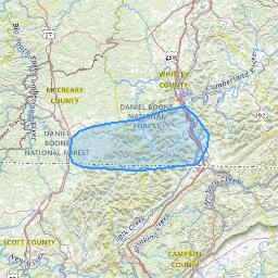
Location
Local offices
Endangered species
This resource list is for informational purposes only and does not constitute an analysis of project level impacts.
The primary information used to generate this list is the known or expected range of each species. Additional areas of influence (AOI) for species are also considered. An AOI includes areas outside of the species range if the species could be indirectly affected by activities in that area (e.g., placing a dam upstream of a fish population even if that fish does not occur at the dam site, may indirectly impact the species by reducing or eliminating water flow downstream). Because species can move, and site conditions can change, the species on this list are not guaranteed to be found on or near the project area. To fully determine any potential effects to species, additional site-specific and project-specific information is often required.
Section 7 of the Endangered Species Act requires Federal agencies to "request of the Secretary information whether any species which is listed or proposed to be listed may be present in the area of such proposed action" for any project that is conducted, permitted, funded, or licensed by any Federal agency. A letter from the local office and a species list which fulfills this requirement can only be obtained by requesting an official species list from either the Regulatory Review section in IPaC (see directions below) or from the local field office directly.
For project evaluations that require USFWS concurrence/review, please return to the IPaC website and request an official species list by doing the following:
- Draw the project location and click CONTINUE.
- Click DEFINE PROJECT.
- Log in (if directed to do so).
- Provide a name and description for your project.
- Click REQUEST SPECIES LIST.
Listed species1 and their critical habitats are managed by the Ecological Services Program of the U.S. Fish and Wildlife Service (USFWS) and the fisheries division of the National Oceanic and Atmospheric Administration (NOAA Fisheries2).
Species and critical habitats under the sole responsibility of NOAA Fisheries are not shown on this list. Please contact NOAA Fisheries for species under their jurisdiction.
Additional information on endangered species data is provided below.
-
Species listed under the Endangered Species Act are threatened or endangered; IPaC also shows species that are candidates, or proposed, for listing. See the listing status page for more information. IPaC only shows species that are regulated by USFWS (see FAQ).
- NOAA Fisheries, also known as the National Marine Fisheries Service (NMFS), is an office of the National Oceanic and Atmospheric Administration within the Department of Commerce.
The following species are potentially affected by activities in this location:
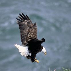
Bald & Golden Eagles
Bald and Golden Eagles are protected under the Bald and Golden Eagle Protection Act 2 and the Migratory Bird Treaty Act (MBTA) 1. Any person or organization who plans or conducts activities that may result in impacts to Bald or Golden Eagles, or their habitats, should follow appropriate regulations and consider implementing appropriate avoidance and minimization measures, as described in the various links on this page.
Additional information can be found using the following links:
- Eagle Management https://www.fws.gov/program/eagle-management
- Measures for avoiding and minimizing impacts to birds https://www.fws.gov/library/collections/avoiding-and-minimizing-incidental-take-migratory-birds
- Nationwide avoidance and minimization measures for birds https://www.fws.gov/sites/default/files/documents/nationwide-standard-conservation-measures.pdf
- Supplemental Information for Migratory Birds and Eagles in IPaC https://www.fws.gov/media/supplemental-information-migratory-birds-and-bald-and-golden-eagles-may-occur-project-action
There are Bald Eagles and/or Golden Eagles in your project area.
Measures for Proactively Minimizing Eagle ImpactsFor information on how to best avoid and minimize disturbance to nesting bald eagles, please review the National Bald Eagle Management Guidelines. You may employ the timing and activity-specific distance recommendations in this document when designing your project/activity to avoid and minimize eagle impacts. For bald eagle information specific to Alaska, please refer to Bald Eagle Nesting and Sensitivity to Human Activity.
The FWS does not currently have guidelines for avoiding and minimizing disturbance to nesting Golden Eagles. For site-specific recommendations regarding nesting Golden Eagles, please consult with the appropriate Regional Migratory Bird Office or Ecological Services Field Office.
If disturbance or take of eagles cannot be avoided, an incidental take permit may be available to authorize any take that results from, but is not the purpose of, an otherwise lawful activity. For assistance making this determination for Bald Eagles, visit the Do I Need A Permit Tool. For assistance making this determination for golden eagles, please consult with the appropriate Regional Migratory Bird Office or Ecological Services Field Office.
Ensure Your Eagle List is Accurate and CompleteIf your project area is in a poorly surveyed area in IPaC, your list may not be complete and you may need to rely on other resources to determine what species may be present (e.g. your local FWS field office, state surveys, your own surveys). Please review the Supplemental Information on Migratory Birds and Eagles, to help you properly interpret the report for your specified location, including determining if there is sufficient data to ensure your list is accurate.
For guidance on when to schedule activities or implement avoidance and minimization measures to reduce impacts to bald or golden eagles on your list, see the "Probability of Presence Summary" below to see when these bald or golden eagles are most likely to be present and breeding in your project area.
Review the FAQsThe FAQs below provide important additional information and resources.
Probability of Presence Summary
The graphs below provide our best understanding of when birds of concern are most likely to be present in your project area. This information can be used to tailor and schedule your project activities to avoid or minimize impacts to birds. Please make sure you read "Supplemental Information on Migratory Birds and Eagles", specifically the FAQ section titled "Proper Interpretation and Use of Your Migratory Bird Report" before using or attempting to interpret this report.
Probability of Presence (
Each green bar represents the bird's relative probability of presence in the 10km grid cell(s) your project overlaps during a particular week of the year. (A year is represented as 12 4-week months.) A taller bar indicates a higher probability of species presence. The survey effort (see below) can be used to establish a level of confidence in the presence score. One can have higher confidence in the presence score if the corresponding survey effort is also high.
How is the probability of presence score calculated? The calculation is done in three steps:
- The probability of presence for each week is calculated as the number of survey events in the week where the species was detected divided by the total number of survey events for that week. For example, if in week 12 there were 20 survey events and the Spotted Towhee was found in 5 of them, the probability of presence of the Spotted Towhee in week 12 is 0.25.
- To properly present the pattern of presence across the year, the relative probability of presence is calculated. This is the probability of presence divided by the maximum probability of presence across all weeks. For example, imagine the probability of presence in week 20 for the Spotted Towhee is 0.05, and that the probability of presence at week 12 (0.25) is the maximum of any week of the year. The relative probability of presence on week 12 is 0.25/0.25 = 1; at week 20 it is 0.05/0.25 = 0.2.
- The relative probability of presence calculated in the previous step undergoes a statistical conversion so that all possible values fall between 0 and 10, inclusive. This is the probability of presence score.
To see a bar's probability of presence score, simply hover your mouse cursor over the bar.
Breeding Season (Yellow bars denote a very liberal estimate of the time-frame inside which the bird breeds across its entire range. If there are no yellow bars shown for a bird, it does not breed in your project area.
Survey Effort (Vertical black lines superimposed on probability of presence bars indicate the number of surveys performed for that species in the 10km grid cell(s) your project area overlaps. The number of surveys is expressed as a range, for example, 33 to 64 surveys.
To see a bar's survey effort range, simply hover your mouse cursor over the bar.
No Data (A week is marked as having no data if there were no survey events for that week.
Survey TimeframeSurveys from only the last 10 years are used in order to ensure delivery of currently relevant information. The exception to this is areas off the Atlantic coast, where bird returns are based on all years of available data, since data in these areas is currently much more sparse.
| Species | Jan | Feb | Mar | Apr | May | Jun | Jul | Aug | Sep | Oct | Nov | Dec |
|---|---|---|---|---|---|---|---|---|---|---|---|---|
|
Bald Eagle
Non-BCC Vulnerable
Non-BCC Vulnerable
|
Bald & Golden Eagles FAQs
The potential for eagle presence is derived from data provided by the Avian Knowledge Network (AKN). The AKN data is based on a growing collection of survey, banding, and citizen science datasets and is queried and filtered to return a list of those birds reported as occurring in the 10km grid cell(s) which your project intersects, and that have been identified as warranting special attention because they are an eagle (Bald and Golden Eagle Protection Act requirements may apply).
Proper interpretation and use of your eagle reportOn the graphs provided, please look carefully at the survey effort (indicated by the black vertical line) and for the existence of the "no data" indicator (a red horizontal line). A high survey effort is the key component. If the survey effort is high, then the probability of presence score can be viewed as more dependable. In contrast, a low survey effort line or no data line (red horizontal) means a lack of data and, therefore, a lack of certainty about presence of the species. This list is not perfect; it is simply a starting point for identifying what birds have the potential to be in your project area, when they might be there, and if they might be breeding (which means nests might be present). The list and associated information help you know what to look for to confirm presence and helps guide you in knowing when to implement avoidance and minimization measures to eliminate or reduce potential impacts from your project activities or get the appropriate permits should presence be confirmed.
To see what part of a particular bird's range your project area falls within (i.e. breeding, wintering, migrating, or resident), you may query your location using the RAIL Tool and view the range maps provided for birds in your area at the bottom of the profiles provided for each bird in your results. If an eagle on your IPaC migratory bird species list has a breeding season associated with it (indicated by yellow vertical bars on the phenology graph in your “IPaC PROBABILITY OF PRESENCE SUMMARY” at the top of your results list), there may be nests present at some point within the timeframe specified. If "Breeds elsewhere" is indicated, then the bird likely does not breed in your project area.
Interpreting the Probability of Presence Graphs
Each green bar represents the bird's relative probability of presence in the 10km grid cell(s) your project overlaps during a particular week of the year. A taller bar indicates a higher probability of species presence. The survey effort can be used to establish a level of confidence in the presence score.
How is the probability of presence score calculated? The calculation is done in three steps:The probability of presence for each week is calculated as the number of survey events in the week where the species was detected divided by the total number of survey events for that week. For example, if in week 12 there were 20 survey events and the Spotted Towhee was found in 5 of them, the probability of presence of the Spotted Towhee in week 12 is 0.25.
To properly present the pattern of presence across the year, the relative probability of presence is calculated. This is the probability of presence divided by the maximum probability of presence across all weeks. For example, imagine the probability of presence in week 20 for the Spotted Towhee is 0.05, and that the probability of presence at week 12 (0.25) is the maximum of any week of the year. The relative probability of presence on week 12 is 0.25/0.25 = 1; at week 20 it is 0.05/0.25 = 0.2.
The relative probability of presence calculated in the previous step undergoes a statistical conversion so that all possible values fall between 0 and 10, inclusive. This is the probability of presence score.
Breeding Season ()Yellow bars denote a very liberal estimate of the time-frame inside which the bird breeds across its entire range. If there are no yellow bars shown for a bird, it does not breed in your project area.
Survey Effort ()Vertical black lines superimposed on probability of presence bars indicate the number of surveys performed for that species in the 10km grid cell(s) your project area overlaps.
No Data ()A week is marked as having no data if there were no survey events for that week.
Survey TimeframeSurveys from only the last 10 years are used in order to ensure delivery of currently relevant information. The exception to this is areas off the Atlantic coast, where bird returns are based on all years of available data, since data in these areas is currently much more sparse.
Migratory birds
The Migratory Bird Treaty Act (MBTA) 1 prohibits the take (including killing, capturing, selling, trading, and transport) of protected migratory bird species without prior authorization by the Department of Interior U.S. Fish and Wildlife Service (Service).
-
The Migratory Birds Treaty Act of 1918.
-
The Bald and Golden Eagle Protection Act of 1940.
Additional information can be found using the following links:
- Eagle Management https://www.fws.gov/program/eagle-management
- Measures for avoiding and minimizing impacts to birds https://www.fws.gov/library/collections/avoiding-and-minimizing-incidental-take-migratory-birds
- Nationwide avoidance and minimization measures for birds
- Supplemental Information for Migratory Birds and Eagles in IPaC https://www.fws.gov/media/supplemental-information-migratory-birds-and-bald-and-golden-eagles-may-occur-project-action
Measures for Proactively Minimizing Migratory Bird Impacts
Your IPaC Migratory Bird list showcases birds of concern, including Birds of Conservation Concern (BCC), in your project location. This is not a comprehensive list of all birds found in your project area. However, you can help proactively minimize significant impacts to all birds at your project location by implementing the measures in the Nationwide avoidance and minimization measures for birds document, and any other project-specific avoidance and minimization measures suggested at the link Measures for avoiding and minimizing impacts to birds for the birds of concern on your list below.
Ensure Your Migratory Bird List is Accurate and Complete
If your project area is in a poorly surveyed area, your list may not be complete and you may need to rely on other resources to determine what species may be present (e.g. your local FWS field office, state surveys, your own surveys). Please review the Supplemental Information on Migratory Birds and Eagles document, to help you properly interpret the report for your specified location, including determining if there is sufficient data to ensure your list is accurate.
For guidance on when to schedule activities or implement avoidance and minimization measures to reduce impacts to migratory birds on your list, see the "Probability of Presence Summary" below to see when these birds are most likely to be present and breeding in your project area.
Review the FAQsThe FAQs below provide important additional information and resources.
Probability of Presence Summary
The graphs below provide our best understanding of when birds of concern are most likely to be present in your project area. This information can be used to tailor and schedule your project activities to avoid or minimize impacts to birds. Please make sure you read "Supplemental Information on Migratory Birds and Eagles", specifically the FAQ section titled "Proper Interpretation and Use of Your Migratory Bird Report" before using or attempting to interpret this report.
Probability of Presence (
Each green bar represents the bird's relative probability of presence in the 10km grid cell(s) your project overlaps during a particular week of the year. (A year is represented as 12 4-week months.) A taller bar indicates a higher probability of species presence. The survey effort (see below) can be used to establish a level of confidence in the presence score. One can have higher confidence in the presence score if the corresponding survey effort is also high.
How is the probability of presence score calculated? The calculation is done in three steps:
- The probability of presence for each week is calculated as the number of survey events in the week where the species was detected divided by the total number of survey events for that week. For example, if in week 12 there were 20 survey events and the Spotted Towhee was found in 5 of them, the probability of presence of the Spotted Towhee in week 12 is 0.25.
- To properly present the pattern of presence across the year, the relative probability of presence is calculated. This is the probability of presence divided by the maximum probability of presence across all weeks. For example, imagine the probability of presence in week 20 for the Spotted Towhee is 0.05, and that the probability of presence at week 12 (0.25) is the maximum of any week of the year. The relative probability of presence on week 12 is 0.25/0.25 = 1; at week 20 it is 0.05/0.25 = 0.2.
- The relative probability of presence calculated in the previous step undergoes a statistical conversion so that all possible values fall between 0 and 10, inclusive. This is the probability of presence score.
To see a bar's probability of presence score, simply hover your mouse cursor over the bar.
Breeding Season (Yellow bars denote a very liberal estimate of the time-frame inside which the bird breeds across its entire range. If there are no yellow bars shown for a bird, it does not breed in your project area.
Survey Effort (Vertical black lines superimposed on probability of presence bars indicate the number of surveys performed for that species in the 10km grid cell(s) your project area overlaps. The number of surveys is expressed as a range, for example, 33 to 64 surveys.
To see a bar's survey effort range, simply hover your mouse cursor over the bar.
No Data (A week is marked as having no data if there were no survey events for that week.
Survey TimeframeSurveys from only the last 10 years are used in order to ensure delivery of currently relevant information. The exception to this is areas off the Atlantic coast, where bird returns are based on all years of available data, since data in these areas is currently much more sparse.
| Species | Jan | Feb | Mar | Apr | May | Jun | Jul | Aug | Sep | Oct | Nov | Dec |
|---|---|---|---|---|---|---|---|---|---|---|---|---|
|
Bald Eagle
Non-BCC Vulnerable
Non-BCC Vulnerable
|
||||||||||||
|
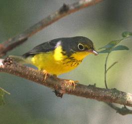
Canada Warbler
BCC Rangewide (CON)
BCC Rangewide (CON)
|
||||||||||||
|
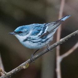
Cerulean Warbler
BCC Rangewide (CON)
BCC Rangewide (CON)
|
||||||||||||
|
Chimney Swift
BCC Rangewide (CON)
BCC Rangewide (CON)
|
||||||||||||
|
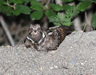
Eastern Whip-poor-will
BCC Rangewide (CON)
BCC Rangewide (CON)
|
||||||||||||
|
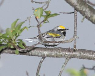
Golden-winged Warbler
BCC Rangewide (CON)
BCC Rangewide (CON)
|
||||||||||||
|
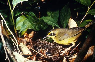
Kentucky Warbler
BCC Rangewide (CON)
BCC Rangewide (CON)
|
||||||||||||
|
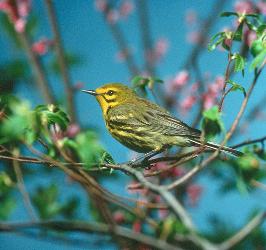
Prairie Warbler
BCC Rangewide (CON)
BCC Rangewide (CON)
|
||||||||||||
|
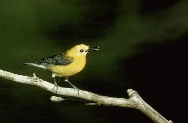
Prothonotary Warbler
BCC Rangewide (CON)
BCC Rangewide (CON)
|
||||||||||||
|
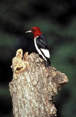
Red-headed Woodpecker
BCC Rangewide (CON)
BCC Rangewide (CON)
|
||||||||||||
|
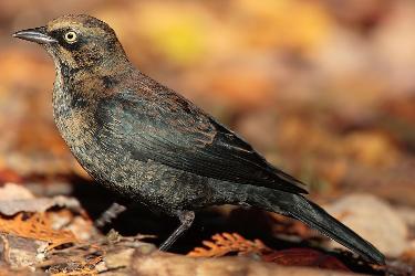
Rusty Blackbird
BCC - BCR
BCC - BCR
|
||||||||||||
|
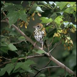
Wood Thrush
BCC Rangewide (CON)
BCC Rangewide (CON)
|
Migratory Bird FAQs
Nationwide Avoidance & Minimization Measures for Birds describes measures that can help avoid and minimize impacts to all birds at any location year-round. When birds may be breeding in the area, identifying the locations of any active nests and avoiding their destruction is one of the most effective ways to minimize impacts. To see when birds are most likely to occur and breed in your project area, view the Probability of Presence Summary. Additional measures or permits may be advisable depending on the type of activity you are conducting and the type of infrastructure or bird species present on your project site.
The Migratory Bird Resource List is comprised of Birds of Conservation Concern (BCC) and other species that may warrant special attention in your project location, such as those listed under the Endangered Species Act or the Bald and Golden Eagle Protection Act and those species marked as “Vulnerable”. See the FAQ “What are the levels of concern for migratory birds?” for more information on the levels of concern covered in the IPaC migratory bird species list.
The migratory bird list generated for your project is derived from data provided by the Avian Knowledge Network (AKN). The AKN data is based on a growing collection of survey, banding, and citizen science datasets and is queried and filtered to return a list of those birds reported as occurring in the 10km grid cell(s) with which your project intersects. These species have been identified as warranting special attention because they are BCC species in that area, an eagle (Bald and Golden Eagle Protection Act requirements may apply), or a species that has a particular vulnerability to offshore activities or development.
Again, the Migratory Bird Resource list includes only a subset of birds that may occur in your project area. It is not representative of all birds that may occur in your project area. To get a list of all birds potentially present in your project area, and to verify survey effort when no results present, please visit the Rapid Avian Information Locator (RAIL) Tool.
Subspecies profiles are included on the list of species present in your project area because observations in the AKN for the species are being detected. If the species are present, that means that the subspecies may also be present. If a subspecies shows up on your list, you may need to rely on other resources to determine if that subspecies may be present (e.g. your local FWS field office, state surveys, your own surveys).
The probability of presence graphs associated with your migratory bird list are based on data provided by the Avian Knowledge Network (AKN). This data is derived from a growing collection of survey, banding, and citizen science datasets.
Probability of presence data is continuously being updated as new and better information becomes available. To learn more about how the probability of presence graphs are produced and how to interpret them, go to the Probability of Presence Summary and then click on the "Tell me about these graphs" link.
To see what part of a particular bird's range your project area falls within (i.e. breeding, wintering, migrating, or resident), you may query your location using the RAIL Tool and view the range maps provided for birds in your area at the bottom of the profiles provided for each bird in your results. If a bird on your IPaC migratory bird species list has a breeding season associated with it (indicated by yellow vertical bars on the phenology graph in your “IPaC PROBABILITY OF PRESENCE SUMMARY” at the top of your results list), there may be nests present at some point within the timeframe specified. If "Breeds elsewhere" is indicated, then the bird likely does not breed in your project area.
Migratory birds delivered through IPaC fall into the following distinct categories of concern:
- "BCC Rangewide" birds are Birds of Conservation Concern (BCC) that are of concern throughout their range anywhere within the USA (including Hawaii, the Pacific Islands, Puerto Rico, and the Virgin Islands);
- "BCC - BCR" birds are BCCs that are of concern only in particular Bird Conservation Regions (BCRs) in the continental USA; and
- "Non-BCC - Vulnerable" birds are not BCC species in your project area, but appear on your list either because of the Bald and Golden Eagle Protection Act requirements (for eagles) or (for non-eagles) potential susceptibilities in offshore areas from certain types of development or activities (e.g. offshore energy development or longline fishing).
Although it is important to avoid and minimize impacts to all birds, efforts should be made, in particular, to avoid and minimize impacts to the birds on this list, especially BCC species. For more information on avoidance and minimization measures you can implement to help avoid and minimize migratory bird impacts, please see the FAQ “Tell me more about avoidance and minimization measures I can implement to avoid or minimize impacts to migratory birds”.
For additional details about the relative occurrence and abundance of both individual bird species and groups of bird species within your project area off the Atlantic Coast, please visit the Northeast Ocean Data Portal. The Portal also offers data and information about other taxa besides birds that may be helpful to you in your project review. Alternately, you may download the bird model results files underlying the portal maps through the NOAA NCCOS Integrative Statistical Modeling and Predictive Mapping of Marine Bird Distributions and Abundance on the Atlantic Outer Continental Shelf project webpage.
The migratory bird list generated is not a list of all birds in your project area, only a subset of birds of priority concern. To learn more about how your list is generated and see options for identifying what other birds may be in your project area, please see the FAQ "What does IPaC use to generate the migratory birds potentially occurring in my specified location". Please be aware this report provides the "probability of presence" of birds within the 10 km grid cell(s) that overlap your project; not your exact project footprint. On the graphs provided, please look carefully at the survey effort (indicated by the black vertical line) and for the existence of the "no data" indicator (a red horizontal line). A high survey effort is the key component. If the survey effort is high, then the probability of presence score can be viewed as more dependable. In contrast, a low survey effort bar or no data bar means a lack of data and, therefore, a lack of certainty about presence of the species. This list does not represent all birds present in your project area. It is simply a starting point for identifying what birds of concern have the potential to be in your project area, when they might be there, and if they might be breeding (which means nests might be present). The list and associated information help you know what to look for to confirm presence and helps guide implementation of avoidance and minimization measures to eliminate or reduce potential impacts from your project activities, should presence be confirmed. To learn more about avoidance and minimization measures, visit the FAQ "Tell me about avoidance and minimization measures I can implement to avoid or minimize impacts to migratory birds".
Interpreting the Probability of Presence GraphsEach green bar represents the bird's relative probability of presence in the 10km grid cell(s) your project overlaps during a particular week of the year. A taller bar indicates a higher probability of species presence. The survey effort can be used to establish a level of confidence in the presence score.
How is the probability of presence score calculated? The calculation is done in three steps:The probability of presence for each week is calculated as the number of survey events in the week where the species was detected divided by the total number of survey events for that week. For example, if in week 12 there were 20 survey events and the Spotted Towhee was found in 5 of them, the probability of presence of the Spotted Towhee in week 12 is 0.25.
To properly present the pattern of presence across the year, the relative probability of presence is calculated. This is the probability of presence divided by the maximum probability of presence across all weeks. For example, imagine the probability of presence in week 20 for the Spotted Towhee is 0.05, and that the probability of presence at week 12 (0.25) is the maximum of any week of the year. The relative probability of presence on week 12 is 0.25/0.25 = 1; at week 20 it is 0.05/0.25 = 0.2.
The relative probability of presence calculated in the previous step undergoes a statistical conversion so that all possible values fall between 0 and 10, inclusive. This is the probability of presence score.
Breeding Season ()Yellow bars denote a very liberal estimate of the time-frame inside which the bird breeds across its entire range. If there are no yellow bars shown for a bird, it does not breed in your project area.
Survey Effort ()Vertical black lines superimposed on probability of presence bars indicate the number of surveys performed for that species in the 10km grid cell(s) your project area overlaps.
No Data ()A week is marked as having no data if there were no survey events for that week.
Survey TimeframeSurveys from only the last 10 years are used in order to ensure delivery of currently relevant information. The exception to this is areas off the Atlantic coast, where bird returns are based on all years of available data, since data in these areas is currently much more sparse.
Facilities
National Wildlife Refuge lands
Any activity proposed on lands managed by the National Wildlife Refuge system must undergo a 'Compatibility Determination' conducted by the Refuge. Please contact the individual Refuges to discuss any questions or concerns.
There are no refuge lands at this location.
Fish hatcheries
There are no fish hatcheries at this location.
Wetlands in the National Wetlands Inventory (NWI)
Impacts to NWI wetlands and other aquatic habitats may be subject to regulation under Section 404 of the Clean Water Act, or other State/Federal statutes.
For more information please contact the Regulatory Program of the local U.S. Army Corps of Engineers District.
Wetland information is not available at this time
This can happen when the National Wetlands Inventory (NWI) map service is unavailable, or for very large projects that intersect many wetland areas. Try again, or visit the NWI map to view wetlands at this location.
The Service's objective of mapping wetlands and deepwater habitats is to produce reconnaissance level information on the location, type and size of these resources. The maps are prepared from the analysis of high altitude imagery. Wetlands are identified based on vegetation, visible hydrology and geography. A margin of error is inherent in the use of imagery; thus, detailed on-the-ground inspection of any particular site may result in revision of the wetland boundaries or classification established through image analysis.
The accuracy of image interpretation depends on the quality of the imagery, the experience of the image analysts, the amount and quality of the collateral data and the amount of ground truth verification work conducted. Metadata should be consulted to determine the date of the source imagery used and any mapping problems.
Wetlands or other mapped features may have changed since the date of the imagery or field work. There may be occasional differences in polygon boundaries or classifications between the information depicted on the map and the actual conditions on site.


